About HyTools
HyTools is a python library for processing airborne and spaceborne imaging spectroscopy data, with a focus on terrestrial scenes. At it’s core it consists of functions for reading and writing ENVI formatted images and reading NEON AOP HDF files along with a series of image processing functions including spectral resampling, topographic and BRDF correction, spectral transforms, masking and more. We have also created a series of command line tools which combine these functions and provide a streamlined workflow for processing images.
Examples
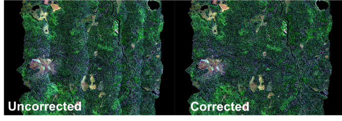
BRDF correction
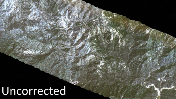
Topographic correction